Showing posts with label Japan-west. Show all posts

view the broad map with a meters above the sea level graph

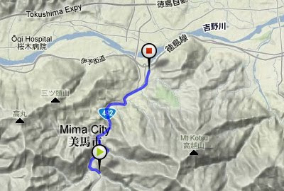
I went down stream on the Akui River with my biking friend by kayak.
We wore life vests, but other than that we had on bike wear. It was a twin-seater kayak like a tandem bike. However, the paddle control is different than the pedal control; the paddle uses not only thrust force. We must synchronize the way of the boat at once.
I recorded a video in a pillion seat. My foot appeared for an instant.

Kudoyama and Koyasan

Aug 26, 2011

view the broad map with a meters above the sea level graph

I stayed in a Japanese hotel in Kudoyama-cho and cycled up to Mt. Koya-san. By chance, the Bon Festival was going on, and I could see farewell bonfires at Sanadaan in Kudoyama.

Kongohbuji temple is on Mt. Koya-san. It rises 750m from the foot of the mountain. This temple is the head temple of Shingon Buddhism.
Its burial ground is packed with the daimyo's graves from the Edo era.
When the property usage donation is not paid every year, the grave is destroyed, and the right to use it is sold to a different person.
This stable business model is lasting 400 years.

 100.03Km

view the broad map with a meters above the sea level graph

1300 years ago, the capital of Japan was Nara.
I cycled on the east hill of the Nara Basin today. This route is called "Yamanobeno michi".
There are many circular mounds, which exceed 250 meters in length. These mounds are surrounded by fields now.

The old forms of Shinto shrines remain. There is neither a sanctuary building nor an altar at Hibara Shrine. Christians interpret this as primitive culture but I think it is the spiritual essence of Japan.

Omiwa Shrine, Ichinomiya of Yamato country.

Because the way is narrow and there are many slopes and stone pavements, it is intended for mountain bikes.

 79.25Km

The distance by road from Shikoku to Tokyo is 800km. I took a ferry because it was slightly too far to go by bicycle.
It's easy when I use the ship because I can carry the bicycle without dismantling it.
As for the fare, it was 10,000 yen per person, 2,800 yen per bicycle, and the travel time was 18 hours.

I waited for the sunrise and started cycling so I arrived at the Tokyo Port before daybreak. I cycled to my house via Ginza, which is the greatest shopping street in Tokyo. Ginza in the early morning was still "sleeping".

view the big map with a meters above the sea level graph

The Great Naruto Bridge, built in 1985, had two layers: a highway and the Shinkansen. However, the government stopped the construction of the Shinkansen, and the first floor was wasted.
A ferry that bicycles could ride ran in the past, but it was discontinued. I cannot cross the straits by bicycle.
To make a bicycle path, in substitution for the Shinkansen, is a wish of the cyclists. It would be an advancement for Japan.

90.74Km / 6hours

view the big map with a meters above the sea level graph

I cycled to Kamiyama-cho to buy bread baked by firewood.
Kamiyama-cho is a depopulated town in the mountains. The municipal government rents out the unoccupied houses at low-cost to revitalize the town. The bakery storekeeper is a couple who moved from Osaka. Because bread is cheap and delicious, they have a good reputation. I bought two pieces of french bread. They are still warm, but will be cold by the time I cycle the 30 kilometers to my house.
Scarecrows decorate the roadside. They are works of art.
The population of the town decreases, but the scarecrows increase.
 
62.5Km / 4hours

A forgotten way

Jan 21, 2011

view the big map with a meters above the sea level graph

The National highway No.11, that links Tokushima to Takamatsu, has changed the route twice. The route that was used until 1953 has been left as a prefectural road. However, the oldest route, which was built in 1875 and used until 1920, is a disused road now.
There was a monument at the starting point of that road. I imagined the time when this place was a trunk line.

The roadbed was made strong and the way was left clear. However, nobody goes now because has been forgotten, and does not appear on any map. When I approached the mountain pass, the road had been covered by bamboo. I got off my bicycle and pushed it.

A bright view opened up when I passed through the shadowy mountain path. It may be 50 years since a person last went this way.
70.56Km / 6hours

Ohkawara Heights

Jan 1, 2011

view the big map with a meters above the sea level graph

I was attracted by the good weather, so I cycled to Ohkawara Heights which was 910m in height. Many cyclists in Tokushima, they usually practices hill climb here.
The temperature was below the freezing point, but became hotter when I began climbing the slope. I took off clothes in sequence, and at last I became only wear a T-shirt only.

In a ridge line of the mountaintop, wind-power generators were lined up. I saw the Great Naruto Bridge where was 50km distant.

66.97km/Total 4h

view the big map with a meters above the sea level graph

This summer, I went to temple No.12: Syosan-ji temple. This part has the steepest slope of the Shikoku pilgrimage.
The distance of uphill slope was 4.5Km and the slant was 10%. The distance was shorter than that of the Syosan-ji temple, but the slant was a bit steeper. I got a backache from cycling on the slant.
The slope became level road when I went up for a ridge line, but it came back to more than 10% for an immediately, and I could not take a break.
Though I am not a Buddhist, I felt I might achieve enlightenment from enduring this struggle!
There was a big temple that had a three-story pagoda built in the Edo era. Because it was the off-season, nobody was there. A strong north wind shook the trees.
58.66km/Total 6h

I was cycling in Yoshino district of Nara which is 100 kilometers south from Kyoto.

Getting a new cycling friend is one of the charms of bicycle touring.
I caught up with a old man who rode a classic bicycle and I talked "Where are you going ?" when riding side by side.
He led me cycling as a local guide.
I saw the monument of revolt of "Tenchugumi", the non-authorized force of the Revering the emperor and expelling the barbarians party.
The Tenchugumi was defeated completely by Shogunate forces in 1863 but this battle became the flash point of Meiji Restoration.

101.81Km /Total 7h


view the big map with a meters above the sea level graph

Because I was going to cross over the mountains today, I wanted to depart early, but decided to participate in a guided early morning worship in the Naiku-Shrine.

Shinto is difficult to understand, like other religions. I thought maybe I could get some idea of what it was about.

God is in the place of nothingness, is not a shrine building

Because I avoided the city and cycled on the old road, neither convenience stores nor the fast food shops were around. I finally found the quiet Ise-noodle dining room. It's said "famous food is generally not good" in Japan. However, the white noodles of this dining room were very delicious. It lived up to its famous name as the Ise-udon.

The upper part: a bad noodle shop in the sightseeing spot. I ate here yesterday.
The lower part: a delicious noodle shop in the country.I ate here today.

99.24Km/Total 10h

view the big map with a meters above the sea level graph

I cycled to temple No.12, Syosan-ji temple. This part has the steepest slope of the Shikoku pilgrimage.
The steep slope of here is called the "pilgrim toppler".
I turned right onto prefectural road 43 from national highway 438 and began a steep slope of 10%. This slope continued all the way to Syosan-ji.
If I had not changed into binding-pedals, I would surely have had to push my bicycle. However, this way I could ride even if it was less than 10km/h.
At Syosan-ji, I met with an heir of a Japanese sweet shop. He was going on a pilgrimage with a GIOS' bicycle. He was touring and camping. He seemed like a very reliable youth.
Surely, one day he will be able to make delicious sweets.

100.9Km/Total 8h


I recorded a GPS log using iTrail every 180 seconds, but the battery of my iPhone lasted only about 3 hours.


view the big map with a meters above the sea level graph

There are still lots of terraced fields in the a mountain village of Shikoku Island.
I went to see the piled stone terraced fields of the Misato village via the Kura pass from the south, Kamiyama-cho.The mountain pass has an incline of 16%. I made it over the steep slope without walking with the help of my binding-type pedals, but it was very slow going.

The people piled up stones on the slope of the mountain and made small fields.
It took several generations to make many terraced fields.
The mechanization advances at fields of level ground. However, the terraced fields are plowed up by human power.
95.24km /Total 8h

The railroad which linked Kyoto to Kanazawa and Fukui has taken another route.
When the Hokuriku-Honsen-Railroad was inaugurated in 1896, the Japanese engineering works did not have the technology to dig a long tunnel, so they avoided the mountains and connected a route along the seashore by 12 short tunnels and four switchbacks. This place was a transportation bottleneck.
The Hokuriku tunnel, inaugurated in 1962, was the longest tunnel in Japan, with a total length is 13,870m.
After the tunnel opened, the old pike(railroad line) was converted into a road. Because the road is narrow, it is rarely used by cars.It is suitable for bicycles, but we must cycle with care because the old tunnels are gloomy and winding.
The ruins of the Suitsu station became the Suitsu rest stop on Hokuriku Expressway.
I left my bicycle behind the rest stop and entered the restaurant. Except me, there are drivers.

79.53Km

view the big map with a meters above the sea level graph

We went down stream of Anabuki River with a kayak today.
Anabuki River is well-known for being pristine in Japan.
At first we put our bikes at the arrival spot, and moved to the departure spot by car.

It was a very hot day, but the wind blowing on the surface of the river was comfortable.
Our kayak was turned around on a rock in the shallows and hit the rock face, however we didn't sink.

We got off a kayak at the river mouth and changed to a bicycle, and went up along the river to take the car.
It was a triathlon, kayaking and cycling and driving, today.

Honen-Ike Dam

Aug 25, 2010

view the big map with a meters above the sea level graph

Honen-Ike Dam, completed in 1930, is Japan's oldest piling-stones dam. It was appointed "Important Cultural Property" in 2006.
I cycled from Awa-Ikeda Station.
The bike featured today is a narrow path bicycle "Lepre" made by Bianchi.
It is a lightweight aluminum frame bicycle.

I passed through the Manda tunnel from R192, down to Kagawa, up along Kunita River, and finally arrived at the site of the dam.
Although it is a small-sized dam with a 30-meter high embankment, I could still watch it up close from under the dam which is open to anyone. The pond of the dam was filled with water.
65.6Km


Japan Part for LABEL

Japan Part for LABEL

Powered by Lang-8 friends

boso.cycle@gmail.com


Taka
If you want to know the details, write a comment or send an email.

free counters