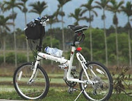
Location information of the GPS is embedded in the photo which I photographed by using iPhone.

I installed the add-on Exif Viewer on FireFox and checked up on the location information.

The seconds are displayed in decimal after the minutes; I calculated them.
latitude 35" 25.66' -> 35" 25' 39.6
longitude 139" 13.17' -> 139" 13' 10.2

By using the "Longitude Latitude Search System" from the Japanese Geographical Survey Institute, I can display the topographical map of the place.

From the photo, you can pinpoint later where you had lost your way.

Attention
If you upload a photo of your house without modification, anyone will be able to pinpoint the location of your home.

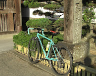
Yabitsu Pass

Apr 18, 2010

view a big map with a meters above the sea level graph

I went to Yabitsu Pass today. Many cyclists come here from Tokyo and Yokohama.

Cyclists are odd people. They come here to climb the steep slope.
Many people climb it by road bike, but I used mini bike.
Even if a road bike overtake me, my feelings were not hurt as I was on a mini bike.

One the way, I saw early leaves of a tree still left with cherry blossoms in Nanohanadai.


The out-of-season snow of the day before yesterday was still visible on the pass, at an altitude of 761 meters.


 112.68Km


Marco who came from Italy, shot scenery with a video camera while cycling downhill, I was overtaken at 8:37.
The video that Marco 'CICLISTA IN GIAPPONE' edited has splendid workmanship, and the image and music matched well.


The old Tokaido 2

Apr 14, 2010

view a big map with a meters above the sea level graph

I cycled from Kanaya Station to Toyohashi Station today.

On the outskirts of the Kanaya post town, the stone pavement of the Edo era is reproduced.

Cobblestones were spread along the path so I could not cycled by small wheel bicycle.


The top of the slope is called "Makinohara plateauan".
There is a tea plantation up there.

Across one of the chokepoint on Tokaido, "Sayono-nakayama", I arrived at the Hisaka post town.

A guide board of "Fifty-three stages of the Tokaido, Hisaka" used Ukiyoe picture by Hiroshige Utagawa.


Sometimes I saw a old night-light called 'Akibasann jyoya-toh".


Rows of pine trees from the Edo era are left here.


102.1Km.
 

The old Tokaido 1

Apr 9, 2010

view a big map with a meters above the sea level graph

The weather is stable now.

I took my bicycle by train from Yokohama Station to Kambara Station today.
I cycled through the Satta and Utsunoya passes of old Tokaido.


A thin haze hung over the Mt. Fuji.

The old row of houses along the town street is left in Utsunoya.


The tunnel of the old national way which was completed in 1936 has an elegant curve.


The tunnel of the Meiji era is preserved as a registered tangible cultural property of the Agency for Cultural Affairs.

87.3Km

The base of Mt. Fuji

Apr 3, 2010

I cycled from Gotemba Station to Higashi-Tagonoura Station
to see Mt. Fuji close-up.

This route runs at the foot of an old volcano between Mt. Fuji and Hakone.

In s straight line from Mt.Fuji, it is about 15Km.
I cycled while gazing at a bunch of mountain on the right hand side.

Mt. Fuji, cherry trees aaaaand paper mills.
61.9Km

view a big map with a meters above the sea level graph

I went to the Yokohama international passenger ship terminal.
Asuka 2 (50,142t) of Nippon Yusen and Nippon-maru (21,903t) of Shosen Mitsui entered the port on that day.
Asuka 2 was departing on a South-West Islands Cruise and Nippon-maru had announced that her major remodeling was finished.

t is unusual for two Japanese first-class passenger ships to arrive in the port at the same time.

I took a digital SLR camera, but the width of the pier wasn't wide to photograph the whole of the ship from the side.
A wide-angle lens is necessary to photograph such a huge subject.

55.8Km。


Japan Part for LABEL

Japan Part for LABEL

Powered by Lang-8 friends

boso.cycle@gmail.com


Taka
If you want to know the details, write a comment or send an email.

free counters