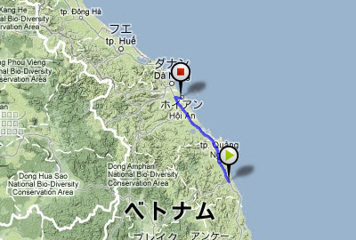
The Saigon - My Tho railway line was inaugurated as the first train service in French Indochina in 1885. It was used after the Indo-China War, undergoing destruction and restoration until 1958. Usually, I used the U.S. army map for an old Vietnam map. However, I only had the 1970 edition, after the line was disused. I traced the route, using a Japanese foreign country, 1/100000 scale, map printed in 1940. The railway that ran side by side on the National Highway QL1 left the road in the Cho Den river, and took a separate route. |
I can definitely find the trace of the route when I look on an aerial photograph on Google. |
This way, a factory siding of the right seems to be a route trace. |
There might be a railroad line alongside palm trees. |
The railroad line had spanned the river here, but I couldn't find the abutment pier trace. |
Across the river, let's search on the opposite bank. There is a way to draw a rail curve. Because the surrounds are ponds and damp ground, this must not have to been an abolished line trace. |
Neighborhood of My Tho. The old road was an abolished line trace, but the way was wide, and I could not find the trace. |
Showing posts with label Vietnam. Show all posts
view the broad map with a meters above the sea level graph
I ride north continuously today at National highway 1. Temperature lowered very much from HCMC. The red earth spreads out, but has a feeling that the transparency of the river increased. |
Chien Dan, Hindu temple of the Champa kingdom. They were made in 11-12 centuries. |
I rode 140km and arrived at Hoian. This was a tourist city. |
149.3 km / 1053.1km |
view the broad map with a meters above the sea level graph
I rode through the mediocre way of the midland today. |
On the roadside, the people made something. |
And there was an amusement place of children. |
Because my father goes for delivery, I tend the store while studying. |
Good "nha nghi", dainty "com" and nice "caphe sua" |
111.0 km / 903.8km |
view the broad map with a meters above the sea level graph
National highway 1D, open cut new road. |
Across a small mountain pass to provincial capital of Binh Dinh, Qui Nhon. |
Slip on a rail track on road, for the first and only time in this trip. |
In the hotel, I was with Russian motorcyclists. They were the tourists who took an animation. |
81.2 km / 792.8km |
view the broad map with a meters above the sea level graph
Dai Lanh fishing port at dawn. There was no breakwater here. Fishermen passed on a pail boat. |
I cycled heading north on National highway No.1. It was another 1185km to Hanoi. |
In a bicycle shop, I oiled a chain. However, it was too thick. |
95.5 km / 711.6km |
view the broad map with a meters above the sea level graph
A color of the Ninh Hoa Station was a darkish yellow peculiar to Vietnam. |
I pedaled a narrow way road in the small village. Village people enjoyed a cockfight by the roadside. |
At the sandbar of Hon Gon, I struggled against a strong wind and a sand stone. |
I arrived at the fishing village called Xom Con, and a chicken came out in the local restaurant where I sat to eat a fish. |
87.4 km / 616.1km |