| I attended the Outreach Symposium, many my friends are on the stage. The panelists are Mr. Minagawa, Grand Master of Suribachi Society, Dr. Ota, Japan Cartographers Association, Dr. Shimada, Nishogakusha University, etc. And the chairman is Associate Professor, Hasegawa. |
| In the afternoon session, we did field work in Arakicho. Of course, the leader was Mr. Minagawa. |
| I drawed the route on the hazard map of the MLIT. This map shows the geological condition of the land. |
| Remains of a bridge, that the river has become a culvert. |
| Suga Shrine, this is the holy place of "Your Name", an animation movie. In Japanese "君の名は。". It has been released in 42 countries including Malaysia. |
| Yato from Shinneiji. |
|
There were temples and shrines on the plateau, and houses of commoners in the lowlands. The Tokyo 1/5000 survey map, 120 years ago. |
| A small pond at the bottom of the valley. This is the remnant of the vassal lord's garden. |
| Banquet after walking around town. We walked with two Malaysian guests. They are graduate students of architecture. I predict that they will start up the Suribachi Society in Malaysia (^_^) |
| The Saigon - My Tho railway line was inaugurated as the first train service in French Indochina in 1885. It was used after the Indo-China War, undergoing destruction and restoration until 1958. Usually, I used the U.S. army map for an old Vietnam map. However, I only had the 1970 edition, after the line was disused. I traced the route, using a Japanese foreign country, 1/100000 scale, map printed in 1940. The railway that ran side by side on the National Highway QL1 left the road in the Cho Den river, and took a separate route. |
| I can definitely find the trace of the route when I look on an aerial photograph on Google. |
| This way, a factory siding of the right seems to be a route trace. |
| There might be a railroad line alongside palm trees. |
| The railroad line had spanned the river here, but I couldn't find the abutment pier trace. |
|
Across the river, let's search on the opposite bank. There is a way to draw a rail curve. Because the surrounds are ponds and damp ground, this must not have to been an abolished line trace. |
| Neighborhood of My Tho. The old road was an abolished line trace, but the way was wide, and I could not find the trace. |
view the broad map with a meters above the sea level graph
| I ride north continuously today at National highway 1. Temperature lowered very much from HCMC. The red earth spreads out, but has a feeling that the transparency of the river increased. |
Chien Dan, Hindu temple of the Champa kingdom. They were made in 11-12 centuries. |
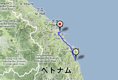
I rode 140km and arrived at Hoian. This was a tourist city. |
149.3 km / 1053.1km |
view the broad map with a meters above the sea level graph
| I rode through the mediocre way of the midland today. |
On the roadside, the people made something. |
And there was an amusement place of children. |
Because my father goes for delivery, I tend the store while studying. |
Good "nha nghi", dainty "com" and nice "caphe sua" |
111.0 km / 903.8km |
view the broad map with a meters above the sea level graph
| National highway 1D, open cut new road. |
Across a small mountain pass to provincial capital of Binh Dinh, Qui Nhon. |
Slip on a rail track on road, for the first and only time in this trip. |
In the hotel, I was with Russian motorcyclists. They were the tourists who took an animation. |
81.2 km / 792.8km |


