My journey will continue as long as there's the smile of people. (3:18)


My journey will continue as long as there's the smile of people. (3:18)
 |
| We can see that a railroad line extended from the Saigon Station to the Ben Thanh Market in the 1/12500 map of Saigon at 1962. According to "the building guide" on the reverse side of the map, the present Saigon Station was a "Freight Station," and in front of Ben Thanh Market the station was the "Railway Station". The passenger station was in front of the market of in the inner-city. |
The rotary is in front of the Ben Thanh Market.
 |
There is a slender park ahead of there. The remains of the ancient structure of the station were not evident, but here was old Saigon Station.  |
The string of one-storied stores built along the curved rail bed. Surely, here is a vestige of a defunct railroad.  |
The depth of the stores conforms to the width of the double track.  |
By the rotary of 7 streets, a train ran in the alley to the front.  |
Saigon Station now, there is the trace of the freight station days.  |
|
|
I ride north continuously today at National highway 1.
Temperature lowered very much from HCMC. The red earth spreads out, but has a feeling that the transparency of the river increased.
 |
Chien Dan, Hindu temple of the Champa kingdom. They were made in 11-12 centuries.  |
 |
 |
 |
 |
 |
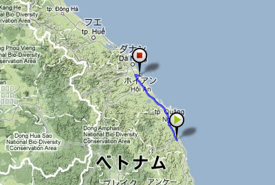
I rode 140km and arrived at Hoian. This was a tourist city.  |
149.3 km / 1053.1km |

I rode through the mediocre way of the midland today.
 |
On the roadside, the people made something.  |
And there was an amusement place of children.  |
Because my father goes for delivery, I tend the store while studying.  |
 |
Good "nha nghi", dainty "com" and nice "caphe sua"  |
111.0 km / 903.8km |

National highway 1D, open cut new road.
 |
Across a small mountain pass to provincial capital of Binh Dinh, Qui Nhon.  |
Slip on a rail track on road, for the first and only time in this trip.  |
In the hotel, I was with Russian motorcyclists. They were the tourists who took an animation. 
 |
81.2 km / 792.8km |

Dai Lanh fishing port at dawn. There was no breakwater here. Fishermen passed on a pail boat.

 |
I cycled heading north on National highway No.1. It was another 1185km to Hanoi. 
 |
In a bicycle shop, I oiled a chain. However, it was too thick.  |
95.5 km / 711.6km |

A color of the Ninh Hoa Station was a darkish yellow peculiar to Vietnam.
 |
I pedaled a narrow way road in the small village. Village people enjoyed a cockfight by the roadside.    |
At the sandbar of Hon Gon, I struggled against a strong wind and a sand stone.   |
I arrived at the fishing village called Xom Con, and a chicken came out in the local restaurant where I sat to eat a fish.  |
87.4 km / 616.1km |

I cycled on the Cam Ranh Peninsula around a bay.
This was the last port of the Russian Baltic Fleet in 1905. After US Navy base, the Soviet Union fleet was stationed there.
 |
 |
Nha Trang iss the most famous beach resort in Vietnam, where large, foreign-affiliated, hotels were built.  |
81.4 km / 528.7km |

|
I cycled to Cam Ranh Bay on national highway 27B today. |
There were few place names on the map, and it was the quiet way, large cars were not to be seen.
 |
A long elevated bridge led toa rice field. What is it?  |
The children of the village led me there. It was a waterway, not a elevated road. 
 |
Across the gentle hills, I was cycling leisurely.  |
I approached the sea, and merged with National Highway 1. I got my dirty bicycle professionally-cleaned in a motorcycle shop.  |
71.7km / 447.3km |


