Bandai to Yonezawa

Oct 30, 2010

view the big map with a meters above the sea level graph

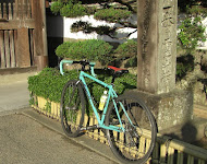
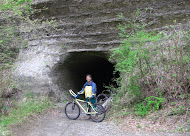
Because the train arrived at Bandaimachi Station at 11:38, and I had to cycle 70km with two mountain passes to Yonezawa, the problem became that I might arrive after sunset.

The weather was clouded and it's occasionally fair, but a cloud hung on the mountaintop of Mt. Bandai-san.

First of all I went 15km to Happohdai (1194m), on an 800m incline.

When I went over the mountain pass, I was able to see a rough north wall.

A river was dammed up by a landslide in the eruption in 1888, and this made many lakes and marshes appear.
Hibara village sits in the Hibara lake.

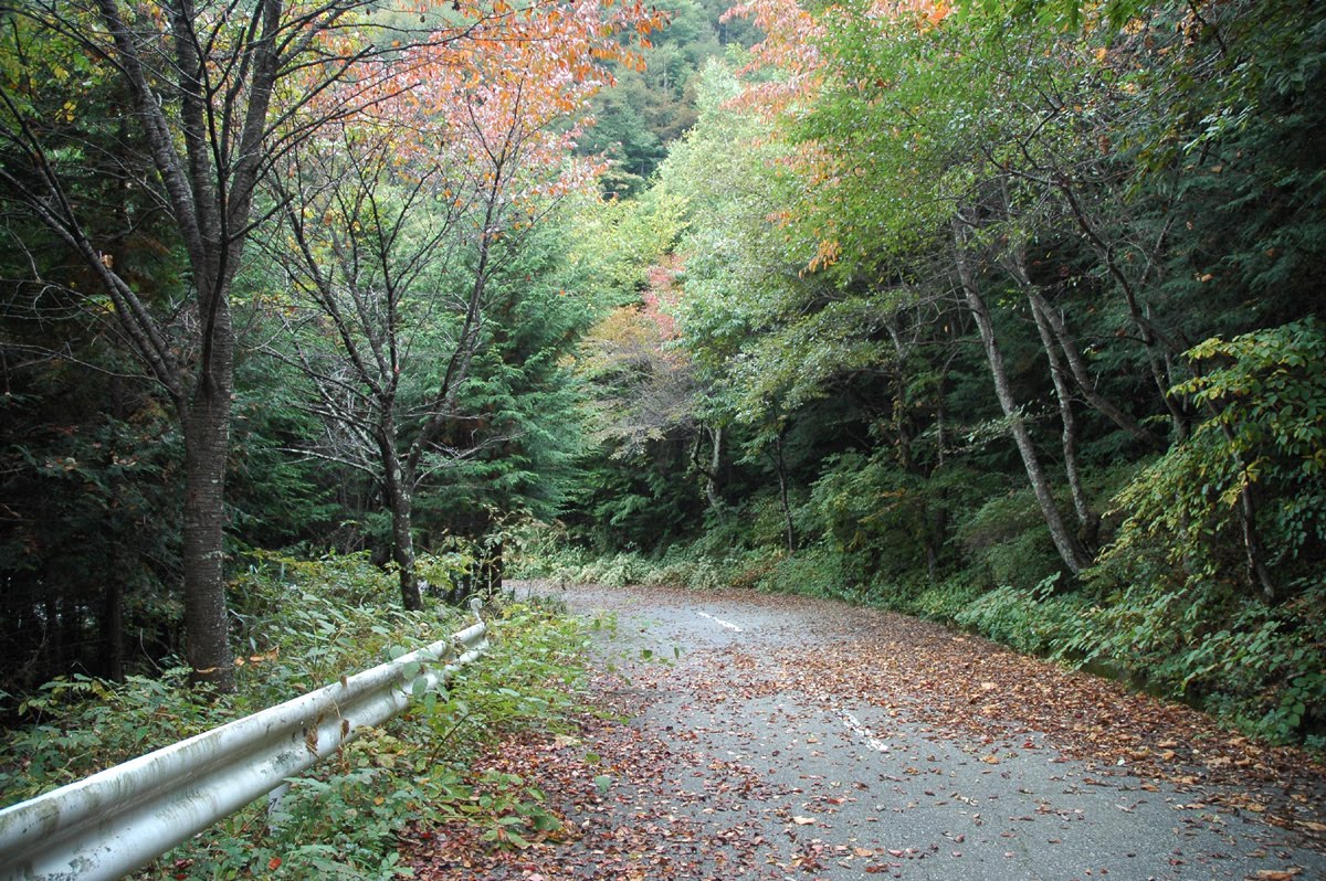
When I passed the flat shore, the climb up to the ridgeline of the Mt. Azuma began. I went up 550m over 8km up to Shiranuno Pass (1420m) on the prefectural border.
I arrived at 17:00, which was one hour behind schedule. The last 10km was a low speed downhill run, while I looked at the night view.

69.13Km/Total 7h

Wooden Bike

Oct 23, 2010

view the big map with a meters above the sea level graph

The Australian cyclist Gus, who gave me the information about the Misaka Pass last week, is staying in Odawara. We decided to meet in Enoshima, which is the halfway point between my home and Odawara.
He owned cottages on the Gold Coast. He said that he is a test pilot of wooden bicycles now !?
He stays in Japan every year for two or three months. He came to Enoshima for the first time and so I guided him around the island.
G: Is that a temple?
T: No, that is a shrink.
G: Taka san, I don't think that is a shrink.
T: Huh, that is a shrine. Don't mind.
He spoke about the wooden bike with passion.
We can make a comfortable bike with enough hardness if we put hard wood and soft wood together.
Carbon cannot have the "bend" that wood has.
There are wooden bike makers such as RENOVO HARDWOOD BICYCLES in U.S.A.
Because he explained it based on the property of the materials, he was persuasive.

76.92Km

view the big map with a meters above the sea level graph

My targets of today are two old mountain passes.
One is Sasago Pass. There, you will find the Koshu-kaido, built in the Edo era/17th century, through which a railroad and a highway pass now.
Another is Misaka Pass. Located there is a road from the Kamakura era/12th century.
According to legend, Yamato Takeru went through on an eastern expedition in the second century.
Both roads I cycled today are old. The traffic decreased after a new tunnel was built. It is a good way to go by bicycle.

The old Sasago tunnel is dignified despite the fact that the width is only 3.0m.
Subsequently, when I tried to go up to Misaka Pass, there was a notice board which said that the route is closed. I was worried whether a bicycle could go or not.
Fortunately for me, one cyclist came down. He is an Australian touring Japan. He said that if you carried your bicycle on your shoulder for 40m, you can pass through the mountain pass.

His blogs are these.
ride japan
boat building practice


It was 40 meters precisely to have carried on.

The road closed to traffic was pleasantly peaceful.

96.8Km/Total 8h

view the big map with a meters above the sea level graph

I cycled from Yamagata to Aterazawa today.
"左沢" which is a name of a location, is difficult to read. It is written as Hidari-Sawa but read as Aterazawa.
This town prospered from water transportation along the Mogami River. Small ships traveled from the upper river to the harbor here in order to transfer cargos to the larger ships.

The old Mogami Bridge, built in 1940, is recognized as "engineering works heritage" by the Japanese Society of Civil Engineers.

The view from the Tateyama park, Information Center told me, was distinguished. A bend in the Mogami River could be seen from the steps at the park.

 29.33Km/Total 4h

view the big map with a meters above the sea level graph

I cycled to Yokohama today.
The distance in a straight line from my home to Yokohama is 12.5km, but there is not a direct route.So I cycled in old Tokaido via the embankment of Tsurumi River.
I went ahead through the reclaimed land to Daikoku Wharf to see Yokohama Bay Bridge.
It is the wharf where Queen Mary 2 (148,528t) arrived in February. QM2 was too big and was not able to dock at the Yokohama International Passenger Terminal.
Yokohama Bay Bridge has two levels. The upper level is the Metropolitan expressway, and the lower level is R375, but bicycles cannot use it.
There is a monument about the Namamugi Incident along the way.
The incident happened in 1862 before the opening of Japan. A Briton who rode across the daimyo's procession on horseback was killed. This resulted in the Anglo-Satsuma War (Bombardment of Kagoshima) between the U.K. and Satsuma feudal clan.
After the war, the Satsuma feudal clan had a friendly relationship with the U.K. and led to Meiji Restoration.

50.9Km/Total 6h

view the big map with a meters above the sea level graph

I visited the Nikaryo-yosui and cycled on the Tama River Cycling Road which goes up to the Sekido Bridge.
The Nikaryo-yosui was/used to be an irrigation ditch, built in the Edo era, and quenched the rice fields south side of the Tama River.
It finished its duty and became a waterside walking road for people now.
The Kuji cylinder watershed, built in 1934, diverted water based on the size of the canal openings at its circumference to each fields.
It was to avoid a scramble for water.

The Tama River cycling road built on the embankment stretches for about 50km.
Japan does not have a functional cycling road like Europe.
Since cyclists and joggers have to coexist here, minor collisions sometimes happen.
There is still some way to go before the Japanese bicycle environment becomes mature.

47.0km/Total 4h

view the big map with a meters above the sea level graph

I cycled to temple No.12, Syosan-ji temple. This part has the steepest slope of the Shikoku pilgrimage.
The steep slope of here is called the "pilgrim toppler".
I turned right onto prefectural road 43 from national highway 438 and began a steep slope of 10%. This slope continued all the way to Syosan-ji.
If I had not changed into binding-pedals, I would surely have had to push my bicycle. However, this way I could ride even if it was less than 10km/h.
At Syosan-ji, I met with an heir of a Japanese sweet shop. He was going on a pilgrimage with a GIOS' bicycle. He was touring and camping. He seemed like a very reliable youth.
Surely, one day he will be able to make delicious sweets.

100.9Km/Total 8h


I recorded a GPS log using iTrail every 180 seconds, but the battery of my iPhone lasted only about 3 hours.


Katakura SILK

Oct 3, 2010

The unsettled autumn skies.
On such a day, I had better advance remodeling of Katakura silk, but it is complex and troublesome.
Katakura silk CRITERIUM (made in 1986)
This bicycle ran the Tour De Yatsugatake in 1988.

Frame:chromium molybdenum steel.
Shimano 600-EX full set.
Rear derailleur:SIS 6 speeds.
Rim: MAVIC, Steering Wheel:Nitto, Saddle:Kashima.

view the big map with a meters above the sea level graph

There are still lots of terraced fields in the a mountain village of Shikoku Island.
I went to see the piled stone terraced fields of the Misato village via the Kura pass from the south, Kamiyama-cho.The mountain pass has an incline of 16%. I made it over the steep slope without walking with the help of my binding-type pedals, but it was very slow going.

The people piled up stones on the slope of the mountain and made small fields.
It took several generations to make many terraced fields.
The mechanization advances at fields of level ground. However, the terraced fields are plowed up by human power.
95.24km /Total 8h


Japan Part for LABEL

Japan Part for LABEL

Powered by Lang-8 friends

boso.cycle@gmail.com


Taka
If you want to know the details, write a comment or send an email.

free counters